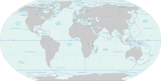
South China Sea
A marginal sea of the Western Pacific Ocean, vital to global trade and fishing.
The South China Sea is a marginal sea within the Western Pacific Ocean. It covers roughly 3,500,000 square kilometers (1,400,000 square miles) and is bordered to the north by South China, to the west by the Indochinese Peninsula, to the east by Taiwan and the northwestern Philippines (primarily Luzon, Mindoro, and Palawan), and to the south by Borneo, eastern Sumatra, and the Bangka Belitung Islands. This sea connects to several other bodies of water: the East China Sea through the Taiwan Strait, the Philippine Sea through the Luzon Strait, the Sulu Sea via straits around Palawan, the Java Sea through the Karimata and Bangka Straits, and directly to the Gulf of Thailand. The Gulf of Tonkin is also considered part of the South China Sea.
In 2016, approximately $3.4 trillion of the world’s $16 trillion in maritime shipping passed through these waters. The area contains discovered oil and natural gas reserves. In 2010, the Western Central Pacific region, which includes this sea, accounted for 14% of global commercial fishing. The South China Sea Islands consist of several archipelago clusters made up of hundreds of mostly small, uninhabited islands, islets (including cays and shoals), reefs, atolls, and seamounts. These features are subject to competing sovereignty claims from multiple countries, a situation reflected in the various names used for both the islands and the sea itself.
The English name "South China Sea" is the standard term in most European languages. It originated from early European interest in the sea as a trade route from Europe and South Asia to China. In the 16th century, Portuguese sailors called it the China Sea (Mare da China); later, to distinguish it from nearby waters, it was renamed the South China Sea. The International Hydrographic Organization officially refers to it as "South China Sea (Nan Hai)."
The earliest Chinese name, Nanfang Hai (Southern Sea), appears in the Yi Zhou Shu, a chronicle of the Western Zhou dynasty (1046–771 BCE), which mentions tributes of hawksbill sea turtles from that sea. During the Spring and Autumn period (771–476 BCE), texts like the Classic of Poetry, Zuo Zhuan, and Guoyu called it Nan Hai (South Sea), referencing expeditions by the State of Chu. Nan Hai was one of the Four Seas in Chinese literature, each corresponding to a cardinal direction. Under the Eastern Han dynasty (23–220 CE), it was known as Zhang Hai (distended sea), and during the Southern and Northern dynasties, Fei Hai (boiling sea) was common. The modern Chinese name, Nan Hai (South Sea), gradually became standard during the Qing dynasty.
In Southeast Asia, the sea was once called the Champa Sea or Sea of Cham, after the maritime kingdom of Champa (in present-day central Vietnam), which thrived there before the 16th century. During World War II, following Japan’s military acquisitions in Southeast Asia in 1941, most of the sea came under Japanese naval control. Japan calls it Minami Shina Kai (South China Sea), written as 南支那海 until 2004, when the spelling was officially changed to 南シナ海, now standard in Japan.
China refers to it as the South Sea (南海; Nánhǎi), while Vietnam calls it the East Sea (Biển Đông). In Malaysia, Indonesia, and the Philippines, it was long known as the South China Sea (Tagalog: Dagat Timog Tsina, Malay: Laut China Selatan). The Philippines historically called the part within its territorial waters the Luzon Sea (Dagat Luzon). After an escalation of the Spratly Islands dispute in 2011, Philippine government agencies began using the name West Philippine Sea. A spokesperson for the Philippine Atmospheric, Geophysical and Astronomical Services Administration (PAGASA) stated that the sea east of the Philippines would continue to be called the Philippine Sea. In September 2012, President Benigno Aquino III signed Administrative Order No. 29, requiring all government agencies to use West Philippine Sea for parts of the South China Sea within the Philippines’ exclusive economic zone, including the Luzon Sea and waters around the Kalayaan Island Group and Bajo de Masinloc. The National Mapping and Resource Information Authority was tasked with using this name on official maps.
In July 2017, Indonesia renamed the northern reaches of its exclusive economic zone in the South China Sea as the North Natuna Sea, located north of the Natuna Islands and bordering southern Vietnam’s exclusive economic zone. This corresponds to the southern end of the South China Sea. The Natuna Sea, south of Natuna Island within Indonesian territorial waters, is a separate portion. Thus, Indonesia has named two seas within the South China Sea: the Natuna Sea, between the Natuna Islands and the Lingga and Tambelan Archipelagos, and the North Natuna Sea, between the Natuna Islands and Cape Cà Mau on the southern tip of the Mekong Delta in Vietnam. No agreement exists between China and Indonesia regarding the Natuna waters dispute, and China has remained ambiguous about the southern limit of its area of interest.
States and territories bordering the sea, listed clockwise from the north, include the People’s Republic of China, the Republic of China (Taiwan), the Philippines, Malaysia, Brunei, Indonesia, and Vietnam. Major rivers flowing into the South China Sea include the Pearl, Min, Jiulong, Red, Mekong, Menam, Rajang, Baram, Kapuas, Batang Hari, Musi, and Kampa.
- area
- approximately 3,500,000 km² (1,400,000 sq mi)
- average_depth
- 1,212 m (3,976 ft)
- deepest_point
- 5,559 m (18,238 ft) or 5,567 m (18,264 ft)
- shipping_value_2016
- $3.4 trillion of $16 trillion global maritime shipping
- fishing_share_2010
- 14% of world's commercial fishing (Western Central Pacific)
- bordering_states
- China, Taiwan, Philippines, Malaysia, Brunei, Indonesia, Vietnam
Lore & Background
The South China Sea opened around 45 million years ago when the 'Dangerous Ground' rifted away from southern China. Extension culminated in seafloor spreading around 30 million years ago, a process that propagated to the southwest, resulting in the V-shaped basin we see today. Extension ceased around 17 million years ago. Arguments have continued about the role of tectonic extrusion in forming the basin. Paul Tapponnier and colleagues have argued that as India collides with Asia, it pushes Indochina to the southeast, causing the South China Sea to open. Marine geophysical studies in the Gulf of Tonkin by Peter Clift have shown that the Red River Fault was active and causing basin formation at least by 37 million years ago in the northwest South China Sea, consistent with extrusion playing a part. During recent ice ages, global sea level was hundreds of metres lower, and Borneo was part of the Asian mainland. The IHO in its Limits of Oceans and Seas, 3rd edition (1953), defines the limits of the South China Sea, but a revised draft edition (1986) recognized the Natuna Sea, revising the southern limit from the Bangka Belitung Islands to the Natuna Islands.
Reader's Guide
The South China Sea is subject to competing claims of sovereignty by several countries. These claims are reflected in the variety of names used for the islands and the sea. In China, it is referred to as the South Sea (南海; Nánhǎi), and in Vietnam the East Sea (Biển Đông). In Malaysia, Indonesia, and the Philippines, it was long known as the South China Sea. Following an escalation of the Spratly Islands dispute in 2011, various Philippine government agencies started using the name West Philippine Sea. In September 2012, Philippine President Benigno Aquino III signed Administrative Order No. 29, mandating that all government agencies use the name West Philippine Sea to refer to the parts of South China Sea within the Philippines exclusive economic zone. In July 2017, to assert its sovereignty, Indonesia renamed the northern reaches of its exclusive economic zone in the South China Sea as the North Natuna Sea. There has been no agreement between China and Indonesia regarding the Natuna waters dispute, with China remaining ambiguous about the southern limit of its area of interest. The South China Sea Islands, collectively comprising several archipelago clusters of mostly small uninhabited islands, islets (cays and shoals), reefs/atolls, and seamounts numbering in the hundreds, are subject to competing claims of sovereignty by several countries.
Did You Know?
- The South China Sea communicates with the East China Sea via the Taiwan Strait, the Philippine Sea via the Luzon Strait, the Sulu Sea via the straits around Palawan, and the Java Sea via the Karimata and Bangka Straits.
- The Yi Zhou Shu, a chronicle of the Western Zhou dynasty (1046–771 BCE), gives the first Chinese name for the South China Sea as Nanfang Hai, meaning 'Southern Sea'.
- In Southeast Asia, it was once called the Champa Sea or Sea of Cham, after the maritime kingdom of Champa (nowadays Central Vietnam), which flourished there before the 16th century.
- The South China Sea has an average depth of 1,212 m (3,976 ft), and the deepest recorded point is either 5,559 m (18,238 ft) or 5,567 m (18,264 ft).
- Major rivers that flow into the South China Sea include the Pearl, Min, Jiulong, Red, Mekong, Menam, Rajang, Baram, Kapuas, Batang Hari, Musi, Kampar, Indragiri, Pahang, Agno, Pampanga, and Pasig Rivers.
Frequently Asked Questions
Who is South China Sea?
South China Sea is a marginal sea of the Western Pacific Ocean, spanning roughly 3.5 million square kilometers and hemmed in by mainland China, the Indochinese Peninsula, Taiwan, the northern Philippines, Borneo, eastern Sumatra, and the Bangka Belitung Islands. Seven states—China, Taiwan, the Philippines, Malaysia, Brunei, Indonesia, and Vietnam—share its coastline, making it one of the most heavily bordered waterways in the region.
What are South China Sea's powers/role?
The sea carries an outsized slice of global commerce; in 2016, approximately $3.4 trillion of the $16 trillion in worldwide maritime trade transited its waters. It also underpins about 14% of the world's commercial fishing output from the Western Central Pacific and hosts substantial offshore oil and gas reserves that drive energy extraction activity.
How does South China Sea's story end?
There is no canonical 'ending'—the sea's narrative is an ongoing, unresolved thread of overlapping sovereignty and exclusive-economic-zone claims among its seven bordering states. As the story stands in current canon, no single treaty or ruling has fully settled the disputes over its islands and surrounding waters.
Why is South China Sea important to the wider Seas and Oceans universe?
Its geographic position links East Asian manufacturing hubs to Western markets, making it a critical chokepoint for global supply chains. Pair that with its rich fisheries and hydrocarbon deposits, and the sea becomes a linchpin for both economic prosperity and strategic security across the broader Pacific.
What are South China Sea's key physical stats?
The sea averages about 1,212 meters in depth but drops to roughly 5,559 meters at its deepest point. With a surface area of approximately 3.5 million square kilometers, it ranks among the larger marginal seas in the Pacific basin.
More in Seas And Oceans 1-24
Related in Seas And Oceans
Links follow this subject's own source article.
Spotted an error? Know more?
This is a living reference — every entry is fact-audited, and reader corrections feed straight into our audit queue. Suggest an edit · See this site's audit record