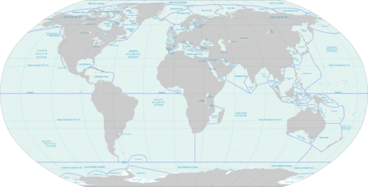
Mozambique Channel
Arm of the Indian Ocean between Madagascar and Mozambique.

Wikipedia / Wikimedia Commons
The Mozambique Channel is an arm of the Indian Ocean located between the Southeast African countries of Madagascar and Mozambique. The channel is about 1,700 km (900 nmi; 1,100 mi) long and 419 km (226 nmi; 260 mi) across at its narrowest point, and reaches a depth of 3,292 m (10,801 ft) about 230 km (124 nmi; 143 mi) off the coast of Mozambique. A warm current, the Mozambique Current, flows in a southward direction in the channel, leading into the Agulhas Current off the east coast of Southern Africa.
- length
- 1,700 km (900 nmi; 1,100 mi)
- narrowest_width
- 419 km (226 nmi; 260 mi)
- maximum_depth
- 3,292 m (10,801 ft)
- location
- Indian Ocean, between Madagascar and Mozambique
- notable_current
- Mozambique Current (warm, southward)
- islands
- Comoros, Mayotte, Glorioso Islands, Juan de Nova Island, Europa Island, Bassas d
Verified Timeline
Lore & Background
The International Hydrographic Organization (IHO) defines the limits of the Mozambique Channel as follows: On the North, a line from the estuary of the River Rovuma (10°28′S 40°26′E) to Ras Habu, the northernmost point of Ile Grande Comore, to Cap d'Ambre (Cape Amber), the northern extremity of Madagascar (11°57′S 49°17′E). On the East, the west coast of Madagascar. On the South, a line from Cap Sainte-Marie, the southern extremity of Madagascar to Ponto do Ouro on the mainland (26°53′S 32°56′E). On the West, the coast of Southern Africa. Islands in the channel include the Comoros (Grande Comore, Mohéli, Anjouan), French territories (Mayotte, claimed by Comoros; the Glorioso Islands, claimed by Madagascar and Comoros; Juan de Nova Island, claimed by Madagascar; Europa Island, claimed by Madagascar; Bassas da India, claimed by Madagascar), and Mozambique's Primeiras and Segundas Archipelago, Ilha do Fogo, and Quirimbas Islands. The St. Lazarus Banks are a seamount located about 50 to 75 nautical miles off the Quirimbas Archipelago, rising from approximately 2,000 m to the shallowest depth of 12 m, famous for marine biodiversity and a major location for deep-sea fishing.
Reader's Guide
The Mozambique Channel carries some 30% of the world's tanker traffic. On 15 November 1939, under the command of Captain Patrick (Paddy) Dove, the British Coastal Tanker Africa Shell was sailing through the channel from Quelimane to Lourenço Marques. At a point 10 nautical miles south-southwest from the lighthouse at Cape Zavora, she was spotted by the German Pocket Battleship Admiral Graf Spee under Captain Hans Langsdorff. Graf Spee ordered the Africa Shell to stop by firing a shot across her bow. A boarding party from Graf Spee addressed Captain Dove with the sentence, 'Good morning, captain. Sorry; fortunes of war.' The party stripped the ship of foodstuffs and a small amount of wine, ordered the crew to row for shore, and took Dove prisoner. Dove protested that the Africa Shell was within Portuguese territorial waters, a violation of international law. The boarding party set scuttling charges and sank the Africa Shell. In 1942, the channel was a World War II clashpoint during the Battle of Madagascar. France maintains a military presence via Réunion, with naval assets patrolling regularly, to preserve sovereignty over Mayotte and the Scattered Islands against claims by Comoros and Madagascar. A recent Islamist insurrection in northern Mozambique has increasingly led to disruption in the channel; the South African Navy has conducted intermittent anti-piracy patrols since 2011.
Did You Know?
- The Mozambique Channel is about 1,700 km long and 419 km across at its narrowest point.
- The channel reaches a depth of 3,292 m about 230 km off the coast of Mozambique.
- On 15 November 1939, the British tanker Africa Shell was sunk in the channel by the German pocket battleship Admiral Graf Spee.
- The St. Lazarus Banks are a seamount rising from approximately 2,000 m to a shallowest depth of 12 m.
- The channel carries some 30% of the world's tanker traffic.
More in Seas And Oceans 1-24
Elsewhere in the Seas And Oceans universe
Spotted an error? Know more?
This is a living reference — every entry is fact-audited, and reader corrections feed straight into our audit queue. Suggest an edit · See this site's audit record