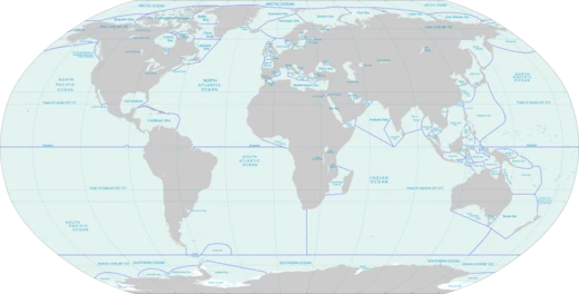
Ross Sea
Southernmost sea on Earth, rich in marine life.

Wikipedia / Wikimedia Commons
The Ross Sea is a deep bay of the Southern Ocean in Antarctica, between Victoria Land and Marie Byrd Land and within the Ross Embayment, and is the southernmost sea on Earth. It derives its name from the British explorer James Clark Ross who visited this area in 1841. To the west of the sea lies Ross Island and Victoria Land, to the east Roosevelt Island and Edward VII Peninsula in Marie Byrd Land, while the southernmost part is covered by the Ross Ice Shelf, and is about 200 miles (320 km) from the South Pole. Its boundaries and area have been defined by the New Zealand National Institute of Water and Atmospheric Research as having an area of 637,000 square kilometres (246,000 sq mi). The circulation of the Ross Sea is dominated by a wind-driven ocean gyre and the flow is strongly influenced by three submarine ridges that run from southwest to northeast. The Ross Sea is covered with ice for most of the year.
- Area
- 637,000 square kilometres (246,000 sq mi)
- Location
- Southern Ocean, Antarctica, between Victoria Land and Marie Byrd Land
- Named after
- British explorer James Clark Ross
- Discovered
- 1841 by the Ross expedition
- Southernmost part
- Covered by the Ross Ice Shelf, about 200 miles (320 km) from the South Pole
- Average shelf depth
- About 500 meters
Verified Timeline
Lore & Background
The Ross Sea was discovered by the Ross expedition in 1841. In the west of the Ross Sea is Ross Island with the Mt. Erebus volcano; in the east is Roosevelt Island. The southern part is covered by the Ross Ice Shelf. Roald Amundsen started his South Pole expedition in 1911 from the Bay of Whales, which was located at the shelf. In the western parts of the Ross Sea, McMurdo Sound is a port that is usually free of ice during the summer. The southernmost part of the Ross Sea is Gould Coast, which is approximately 200 miles (320 km) from the geographic South Pole. The Ross Sea overlies a deep continental shelf, with an average depth of about 500 meters, much deeper than the global average of about 130 meters. This over-deepened condition is due to cycles of erosion and deposition from expanding and contracting ice sheets during Oligocene and later time. Seismic studies in the latter half of the twentieth century defined major features including four north-trending graben systems: the Northern and Victoria Land Basin, the Central Trough, and the Eastern Basin.
Reader's Guide
The Ross Sea is significant as the southernmost sea on Earth and a relatively pristine marine environment. Its nutrient-laden water supports an abundance of plankton and a rich marine fauna, including at least ten mammal species, six bird species, and 95 fish species, as well as many invertebrates. Marine biologists consider the sea to have a high level of biological diversity, and it is the site of much scientific research. The circulation of the Ross Sea is dominated by a wind-driven ocean gyre, and the flow is strongly influenced by three submarine ridges that run from southwest to northeast. The circumpolar deep water current is a relatively warm, salty and nutrient-rich water mass that flows onto the continental shelf at certain locations. New Zealand insists that the sea comes under its jurisdiction as part of the Ross Dependency. In 2016 an international agreement established the region as a marine park. The sea remains relatively unaffected by human activities, making it a focus for environmentalist groups who have campaigned to have the area proclaimed as a world marine reserve. Geologic drilling projects such as the Cape Roberts Project and ANDRILL have recovered cores from the western edges, and the International Ocean Discovery Program Expedition 374 drilled additional holes in 2018 for determining Neogene and Quaternary ice sheet history.
Did You Know?
- The Ross Sea is the southernmost sea on Earth, with its southernmost part covered by the Ross Ice Shelf about 200 miles (320 km) from the South Pole.
- Roald Amundsen started his South Pole expedition in 1911 from the Bay of Whales, which was located at the Ross Ice Shelf.
- The average depth of the Ross Sea continental shelf is about 500 meters, much deeper than the global average of about 130 meters.
- At least ten mammal species, six bird species, and 95 fish species are found in the Ross Sea.
- In 2016 an international agreement established the Ross Sea region as a marine park.
Frequently Asked Questions
Who is Ross Sea?
Ross Sea is the southernmost body of water on Earth, a deep bay of the Southern Ocean tucked between Victoria Land and Marie Byrd Land in Antarctica. It spans roughly 637,000 square kilometres and sits within the Ross Embayment.
What are Ross Sea's powers/role?
For most of the year it is locked under a thick ice cover, and its southern edge is anchored by the massive Ross Ice Shelf, which stretches about 320 km toward the South Pole. Beneath that ice it sustains a remarkably diverse marine community of at least ten mammal species, six bird species, and 95 fish species.
How does Ross Sea's story end?
As of now, Ross Sea has no 'ending'—it remains one of the most untouched regions on the planet, largely free from direct human disruption. Its ongoing narrative is written by the scientists who study it and by a shifting climate that may one day reshape its ice shelf.
Why is Ross Sea important?
Because it sits so close to the South Pole and remains relatively pristine, it serves as a critical natural laboratory for understanding polar ecosystems and climate change. Its average shelf depth of around 500 metres makes it a key site for oceanographic and biological research.
Who named Ross Sea and when?
The sea takes its name from British explorer James Clark Ross, who led an expedition to the region in 1841 and became the first to document the area. His voyage is what gave the Ross Sea and the surrounding Ross Embayment their lasting identity.
More in Seas And Oceans 25-39
Elsewhere in the Seas And Oceans universe
Spotted an error? Know more?
This is a living reference — every entry is fact-audited, and reader corrections feed straight into our audit queue. Suggest an edit · See this site's audit record