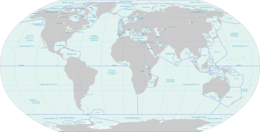
Seto Inland Sea
Marginal sea separating three main Japanese islands.

Wikipedia / Wikimedia Commons
The Seto Inland Sea (瀬戸内海, Seto Naikai), sometimes shortened to the Inland Sea, is the body of water separating Honshu, Shikoku, and Kyushu, three of the four main islands of Japan. It serves as a waterway connecting the Pacific Ocean to the Sea of Japan. It connects to Osaka Bay and provides a sea transport link to industrial centers in the Kansai region, including Osaka and Kobe. Before the construction of the San'yō Main Line, it was the main transportation link between Kansai and Kyūshū. Yamaguchi, Hiroshima, Okayama, Hyōgo, Osaka, Wakayama, Kagawa, Ehime, Tokushima, Fukuoka, and Ōita prefectures have coastlines on the Seto Inland Sea; the cities of Hiroshima, Iwakuni, Takamatsu, and Matsuyama are also located on it.
- Length
- 450 km (280 mi) east to west
- Width
- 15 to 55 km (9.3 to 34.2 mi) south to north
- Average Depth
- 38 meters (125 feet)
- Maximum Depth
- 105 meters (344 feet)
- Number of Islands
- Almost 3,000
- Largest Island
- Awaji-shima
- Second Largest Island
- Shōdo-shima
Lore & Background
The Seto Inland Sea formed after the last ice age when sea water poured into a basin between the Chūgoku mountains and Shikoku mountains. From ancient times, it served as a main transport line between its coastal areas, including what is today the Kansai region and Kyushu, and between Japan and other countries including Korea and China. The importance of water traffic gave rise to private navies called suigun (水軍; "water army"), or simply pirates. During the feudal period, suigun seized power in most coastal areas. The Kono in Iyo Province (today Ehime Prefecture) and Kobayakawa (later Mōri) in Aki Province (today a part of Hiroshima Prefecture) clans were two of the more famous suigun lords. In the 12th century, Taira no Kiyomori planned to move the capital from Kyoto to the coastal village of Fukuhara (today Kobe) to promote trade between Japan and the Song dynasty of China. This transfer was unsuccessful, and soon after Kyoto became the capital again. Later, the Battle of Yashima took place off the coast of present-day Takamatsu. In the Edo period, the Seto Inland Sea was one of the busiest transport lines in Japan, serving daimyōs traveling to and from Edo under sankin-kōtai obligations. Major ports in the Edo period were Osaka, Sakai, Shimotsui, Ushimado, and Tomonoura. After the Meiji Restoration, the coastal cities along the Seto Inland Sea were rapidly industrialized. One of the headquarters of the Japanese Navy was built in the town of Kure. Since the 1980s, the Honshū–Shikoku Bridge Project, including the Great Seto Bridge, which serves both railroad and automobile traffic, has connected the northern and southern shores via three routes.
Reader's Guide
The Seto Inland Sea has been a vital transportation and economic corridor for centuries, linking the Kansai region, Chūgoku, Shikoku, and eastern Kyūshū. Its role as a main transport line diminished after the development of land routes such as the San'yō Main Railroad Line in Honshū and the Yosan Main Railroad Line in Shikoku (both completed before World War II), but it remains important for international cargo transport and local connections between Honshū, Shikoku, and Kyūshū. The sea's moderate climate and beautiful landscape support fishing, agriculture, and tourism. Major industrial cities on its coast include Osaka, Kobe, Hiroshima, Kurashiki, Kure, Fukuyama, Ube, Sakaide, Imabari, and Niihama, with industries ranging from steel production, vehicle manufacture, ship building, textiles, and since the 1960s, oil refining and chemical products. The sea is also known for periodic red tides caused by dense groupings of certain phytoplankton that result in the death of large numbers of fish. Over 500 marine species are known to live in its waters, including the ayu, an amphidromous fish, horseshoe crab, finless porpoise, and great white shark, which has occasionally attacked people in the Seto Inland Sea. Whales, once common, are now rarely seen due to whaling and pollution.
Did You Know?
- The Seto Inland Sea is 450 km (280 mi) long from east to west, but its width varies from only 15 to 55 km (9.3 to 34.2 mi).
- The average depth is 38 meters (125 feet); the greatest depth is 105 meters (344 feet).
- Almost 3,000 islands are located in the Seto Inland Sea; the largest is Awaji-shima, and the second largest is Shōdo-shima.
- The sea experiences periodic red tides caused by dense groupings of certain phytoplankton that result in the death of large numbers of fish.
- Over 500 marine species are known to live in the Seto Inland Sea, including the ayu, horseshoe crab, finless porpoise, and great white shark.
More in Seas And Oceans 25-39
Elsewhere in the Seas And Oceans universe
Spotted an error? Know more?
This is a living reference — every entry is fact-audited, and reader corrections feed straight into our audit queue. Suggest an edit · See this site's audit record