Sargasso Sea
A seaweed-filled Atlantic gyre with no land boundaries.

Wikipedia / Wikimedia Commons
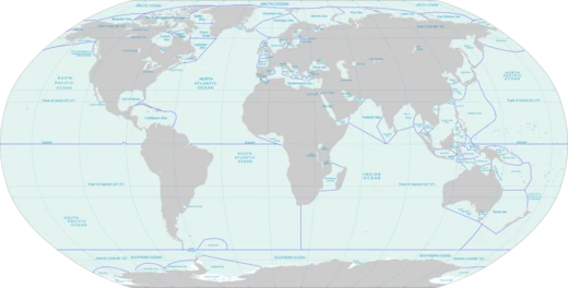
The Sargasso Sea is a region of the Atlantic Ocean bounded by four currents forming an ocean gyre. It is the only named sea without land boundaries. It is distinguished from other parts of the Atlantic Ocean by its characteristic brown Sargassum seaweed and calm blue waters. The sea is bounded on the west by the Gulf Stream, on the north by the North Atlantic Current, on the east by the Canary Current, and on the south by the North Atlantic Equatorial Current, the four together forming a clockwise-circulating system of ocean currents termed the North Atlantic Gyre. It lies between 20° and 35° north and 40° and 70° west and is approximately 1,100 kilometres (600 nautical miles) wide by 3,200 km (1,750 nmi) long. Bermuda is near the western fringes of the sea. Ocean water in the Sargasso Sea is distinctive for its deep blue color and exceptional clarity, with underwater visibility of up to 60 m (200 ft).
- area
- Variable; boundaries shift with ocean currents, typically estimated between 3.5
Verified Timeline
Lore & Background
Portuguese navigators had reached the Sargasso Sea (western North Atlantic region), naming it after the Sargassum seaweed growing there (sargaço or sargasso in Portuguese). Later in 1492, Christopher Columbus wrote about seaweed that he feared would trap his ship and potentially hide shallow waters that could run them aground, as well as a lack of wind that he feared would trap them. The sea may have been known to earlier mariners, as a poem by 4th-century author Avienius describes a portion of the Atlantic as being covered with seaweed and windless, citing a now-lost account by the 5th century BC Carthaginian Himilco the Navigator. Columbus was aware of this account and thought Himilco had reached the Sargasso Sea, as did several other explorers. However, modern scholars consider this unlikely. In 1609, the English vessel Sea Venture was blown to the shore of Bermuda. The sea has also been the site of whaling and fishing. The 1920–1922 Dana expeditions, led by Johannes Schmidt, determined that the European eel's breeding sites were in the Sargasso Sea. The sea has played a role in a number of other pioneering research efforts, including William Beebe and Otis Barton's 1932 dive where they conducted observations of animals and radio broadcasts, John Swallow's work on the Swallow float in the late 1950s, the discovery of Prochlorococcus by a team of researchers in the 1980s, and various oceanographic data gathering programs such as those of Henry Stommel.
Reader's Guide
The Sargasso Sea is home to seaweed of the genus Sargassum, which floats en masse on the surface. The sargassum masses generally are not a threat to shipping, and historic incidents of sailing ships being trapped there are due to the often-calm winds of the horse latitudes. The Sargasso Sea plays a role in the migration of catadromous eel species, such as the European eel, the American eel, and the American conger eel. The larvae of these species hatch within the sea, and as they grow they travel to Europe or the east coast of North America. Later in life, the matured eel migrates back to the Sargasso Sea to spawn and lay eggs. It is also believed that after hatching, young loggerhead sea turtles use currents, such as the Gulf Stream, to travel to the Sargasso Sea, where they use the sargassum as cover from predators until they are mature. The sargassum fish is a species of frogfish specially adapted to blend in among the sargassum seaweed. In the early 2000s, the Sargasso Sea was sampled as part of the Global Ocean Sampling Expedition, to evaluate its diversity of microbial life through metagenomics. Contrary to previous theories, results indicated the area has a wide variety of prokaryotic life. Based on 1975 measurements of oxygen production, and estimates of the total mass of Sargassum in the sea, it can be calculated that the Sargasso Sea may produce 2.2 billion litres of O2 per hour, making the sea one of the primary sources of atmospheric oxygen. The Sargasso Sea, like many unique ocean ecosystems, is under various threats, such as industrial-scale fishing, plastic waste pollution, oil drilling, and deep-sea mining. Owing to surface currents, the Sargasso accumulates a high concentration of non-biodegradable plastic waste. The area contains the huge North Atlantic garbage patch. Several nations and nongovernmental organizations have united to protect the Sargasso Sea. These organizations include the Sargasso Sea Commission established in 2014 by the governments of the Azores (Portugal), Bermuda (United Kingdom), Monaco, the United Kingdom and the United States. Bacteria that consume plastic have been found in the plastic-polluted waters of the Sargasso Sea; however, it is unknown whether these bacteria ultimately clean up poisons or simply spread them elsewhere in the marine microbial ecosystem. Plastic debris can absorb toxic chemicals from ocean pollution, potentially poisoning anything that eats it. Human activity in the Sargasso Sea has negatively affected it, such as over-fishing and shipping. The Sargasso Sea is often portrayed in literature and the media as an area of mystery, where ships and wreckage can become mired in weed for years, even centuries, unable to escape. It serves as a setting for many classic fantasy stories, notably Jules Verne's Twenty Thousand Leagues Under the Seas (1870) and William Hope Hodgson's The Boats of the "Glen Carrig" (1907). The sea is sometimes used purely as a metaphor, such as in modernist poet Ezra Pound's Portrait d'une Femme, which opens with "Your mind and you are our Sargasso Sea", suggesting a repository of trivia and disconnected facts. Also, Jean Rhys's post-colonial retelling of Jane Eyre is titled Wide Sargasso Sea.
Did You Know?
- The Sargasso Sea is the only named sea without land boundaries.
- Underwater visibility in the Sargasso Sea can reach up to 60 m (200 ft).
- The 1920–1922 Dana expeditions, led by Johannes Schmidt, determined that the European eel's breeding sites were in the Sargasso Sea.
- Based on 1975 measurements, the Sargasso Sea may produce 2.2 billion litres of O2 per hour.
- The Sargasso Sea Commission was established in 2014 by the governments of the Azores, Bermuda, Monaco, the United Kingdom, and the United States.
Frequently Asked Questions
What is the Sargasso Sea?
The Sargasso Sea is a region of the North Atlantic Ocean defined not by coastlines but by the four ocean currents that form a circular gyre. It holds the distinction of being the only named sea on Earth with zero land borders.
What makes the Sargasso Sea different from every other sea?
Unlike all other named seas, the Sargasso Sea is entirely enclosed by moving water rather than any coastline. Its edges shift over time as the surrounding currents change, so it has no fixed geographic border at all.
What are the Sargasso Sea's boundaries?
Four major ocean currents — the Gulf Stream, North Atlantic Current, Canary Current, and North Equatorial Current — form a circular loop that defines the gyre. Because these currents are in constant motion, the sea's exact edges are never truly fixed.
Why is the Sargasso Sea famous for seaweed?
The region is well known for its dense accumulations of Sargassum, a free-floating brown seaweed that drifts within the calm gyre. The still, sheltered waters allow the algae to gather into extensive surface mats, which gave the sea its name.
How large is the Sargasso Sea?
Because its borders are defined by shifting currents rather than land, the Sargasso Sea's area is not a single fixed number. Estimates generally place it somewhere between 3.5 and 5 million square kilometers depending on the season and current conditions.
More in Seas And Oceans 25-39
Elsewhere in the Seas And Oceans universe
Spotted an error? Know more?
This is a living reference — every entry is fact-audited, and reader corrections feed straight into our audit queue. Suggest an edit · See this site's audit record