Weddell Sea
A treacherous, ice-filled sea with the clearest water on Earth.

Wikipedia / Wikimedia Commons
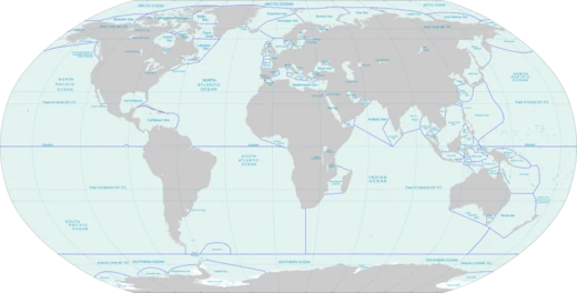
The Weddell Sea is part of the Southern Ocean and contains the Weddell Gyre. Its land boundaries are defined by the bay formed from the coasts of Coats Land and the Antarctic Peninsula. The easternmost point is Cape Norvegia at Princess Martha Coast, Queen Maud Land. To the east of Cape Norvegia is the King Haakon VII Sea. Much of the southern part of the sea is covered by a permanent, massive ice shelf field, the Filchner-Ronne Ice Shelf. The sea is contained within the two overlapping Antarctic territorial claims of Argentine Antarctica, the British Antarctic Territory, and also resides partially within the Antarctic Chilean Territory. At its widest the sea is around 2,000 kilometres across, and its area is around 2.8 million square kilometres. The Weddell Sea has been deemed by scientists to have the clearest water of any sea. Researchers from the Alfred Wegener Institute, on finding a Secchi disc visible at a depth of 80 metres on 13 October 1986, ascertained that the clarity corresponded to that of distilled water.
- area
- approximately 2.8 million square kilometres
- maximum_width
- approximately 2,000 kilometres
- deepest_point
- 3,008 metres (wreck of Endurance)
- named_after
- James Weddell (1787-1834)
- notable_feature
- clearest water of any sea
Verified Timeline
Lore & Background
The sea is named after the Scottish sailor James Weddell (1787-1834), who entered the sea in 1823 and originally named it after King George IV; it was renamed in Weddell's honour in 1900. Also in 1823, the American sealing captain Benjamin Morrell claimed to have seen land some 10–12° east of the sea's actual eastern boundary. He called this New South Greenland, but its existence was disproved when the sea was more fully explored in the early 20th century. Morrell got as far south as 74°S; the furthest southern penetration since Weddell but before the modern era was made by William Speirs Bruce in 1903. In his 1950 book The White Continent, historian Thomas R. Henry writes: 'The Weddell Sea is, according to the testimony of all who have sailed through its berg-filled waters, the most treacherous and dismal region on Earth. The Ross Sea is relatively peaceful, predictable, and safe.' He continues for an entire chapter, relating myths of the green-haired merman sighted in the sea's icy waters, the inability of crews to navigate a path to the coast until 1949, and treacherous 'flash freezes' that left ships, such as Ernest Shackleton's Endurance, at the mercy of the ice floes. In 1915, Ernest Shackleton's ship, Endurance, also got trapped and was later crushed by ice in this sea. After 15 months on the pack-ice Shackleton and his men managed to reach Elephant Island and safely returned home. In March 2022, it was announced that the well-preserved wreck of the Endurance had been discovered four miles (6.4 km) from its anticipated location, at a depth of 3,008 metres (9,869 ft).
Reader's Guide
The Weddell Sea is an important area of deep water mass formation through cabbeling, the main driving force of the thermohaline circulation. Deepwater masses are also formed through cabbeling in the North Atlantic and are caused by differences in temperature and salinity of the water. In the Weddell sea, this is brought about mainly by brine exclusion and wind cooling. Circulation in the western Weddell Sea is dominated by a northward flowing current. This northward current is the western section of a primarily wind-driven, cyclonic gyre called the Weddell Gyre. This northward flow serves as the primary force of departure of water from the Weddell Sea, a major site of ocean water modification and deep water formation, to the remainder of the World Ocean. The Weddell Gyre is a cold, low salinity surface layer separated by a thin, weak pycnocline from a thick layer of relatively warm and salty water referred to as Weddell Deep Water (WDW), and a cold bottom layer. The Weddell Sea is abundant with whales and seals. Characteristic fauna of the sea include the Weddell seal and killer whales, humpback whales, minke whales, leopard seals, and crabeater seals are frequently seen during Weddell Sea voyages. The Adélie penguin is the dominant penguin species in this remote area because of their adaptation to the harsh environment. A colony of more than 100,000 pairs of Adélies can be found on volcanic Paulet Island. Around 1997, the northernmost emperor penguin colony was discovered just south of Snowhill Island in the Weddell Sea. In 2021, sponges and other unidentified suspension feeders were reported to have been found growing under the Filchner-Ronne Ice Shelf on a boulder at a depth of 1,233 m (872 of which were ice), 260 km from open water. In February 2021 the Alfred Wegener Institute for Polar and Marine Research with RV Polarstern, a colony of approximately 60 million Jonah's icefish was found to inhabit an area in the Weddell Sea. It is estimated that the colony covers around 240 square kilometers, with an average of one nest per every three square meters.
Did You Know?
- The Weddell Sea has the clearest water of any sea; a Secchi disc was visible at a depth of 80 metres on 13 October 1986, corresponding to distilled water.
- The wreck of Ernest Shackleton's Endurance was discovered in March 2022 at a depth of 3,008 metres, four miles from its anticipated location.
- In February 2021, a colony of approximately 60 million Jonah's icefish was found in the Weddell Sea, covering around 240 square kilometers.
- In 2021, sponges and other suspension feeders were found growing under the Filchner-Ronne Ice Shelf at a depth of 1,233 m, 260 km from open water.
- The Weddell Sea is named after Scottish sailor James Weddell, who entered it in 1823 and originally named it after King George IV; it was renamed in his honour in 1900.
Frequently Asked Questions
What is the Weddell Sea and where is it located?
The Weddell Sea is a marginal sea of the Southern Ocean tucked between Coats Land and the Antarctic Peninsula, spanning roughly 2.8 million square kilometers. It is one of the most remote and ice-choked bodies of water on the planet.
What makes the Weddell Sea famous?
It holds the record for the clearest water of any sea on Earth, with a Secchi disc still visible at 80 meters depth during a 1986 measurement. That extraordinary transparency coexists with a dense, treacherous permanent ice pack that makes the region notoriously difficult to navigate.
How did the Weddell Sea get its name?
It is named after Scottish sailor James Weddell (1787–1834), who in 1823 became one of the first explorers to sail into the region and chart part of its coastline.
What are the Weddell Sea's key dimensions?
The sea stretches approximately 2,000 kilometers at its widest point and reaches a maximum depth of 3,008 meters near the wreck of the Endurance. Its total area is about 2.8 million square kilometers.
What notable ice formations exist in the Weddell Sea?
The sea is home to the massive Filchner-Ronne Ice Shelf, one of the largest ice shelves in Antarctica. These permanent ice structures, combined with drifting pack ice, make the region extremely hazardous for any vessel attempting passage.
More in Seas And Oceans 25-39
Elsewhere in the Seas And Oceans universe
Spotted an error? Know more?
This is a living reference — every entry is fact-audited, and reader corrections feed straight into our audit queue. Suggest an edit · See this site's audit record