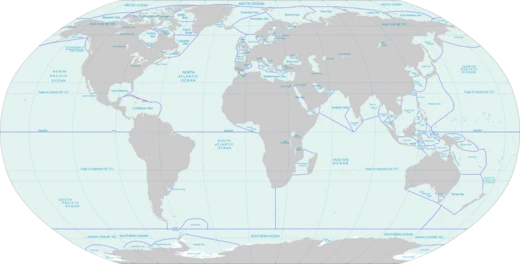
Persian Gulf
A shallow, historically significant sea between Arabia and Iran.

Wikipedia / Wikimedia Commons
The Persian Gulf, sometimes called the Arabian Gulf, is a mediterranean sea in West Asia. The body of water is an extension of the Arabian Sea and the larger Indian Ocean located between the Arabian Peninsula and Iran (Persia). It is connected to the Gulf of Oman in the east by the Strait of Hormuz. The river delta of the Shatt al-Arab forms the north-west shoreline. The Persian Gulf has many fishing grounds, extensive reefs (mostly rocky, but also coral), and abundant pearl oysters; however, its ecology has been damaged by industrialization and oil spills. The Persian Gulf is in the Persian Gulf Basin, which is of Cenozoic origin and related to the subduction of the Arabian plate under the Zagros Mountains. The current flooding of the basin started 15,000 years ago due to rising sea levels of the Holocene glacial retreat.
- Area
- 251,000 square kilometres (96,912 sq mi)
- Length
- 989 kilometres (615 miles)
- Maximum depth
- 90 metres (295 feet)
- Average depth
- 50 metres (164 feet)
- Narrowest width
- 56 km (35 mi) at the Strait of Hormuz
- Countries with coastline
- Iran, Oman, United Arab Emirates, Saudi Arabia, Qatar, Bahrain, Kuwait, Iraq
Lore & Background
The region of the Persian Gulf has been inhabited since the Paleolithic. During most of the Last Glacial Period (115,000–11,700 years Before Present), due to lowered sea levels (reaching around 125 metres below present values during the Last Glacial Maximum) combined with the shallow depth of the Gulf (on average around 35 metres and at max around 100 metres depth), most of the Persian Gulf was exposed as dry land, forming a flat floodplain where a number of rivers converged. The modern marine Gulf was formed when sea level rose during the early Holocene, from around 12,000 to 6,000 years ago. The world's oldest known civilization (Sumer) developed along the Persian Gulf and southern Mesopotamia. The oldest evidence in the world for seagoing vessels has been found at H3 in Kuwait, dating to the mid-sixth millennium BC, when the Gulf was part of an extensive trade network that involved the Ubaid settlements in Mesopotamia and communities along the entire Gulf coast. The name 'Persian Gulf' appears in Greek sources as early as 300 BC, when the word 'Persikon kolpos' is mentioned multiple times in the book of Nearchus known as Indikê. An inscription of Darius the Great from the fifth century BC states: 'King Darius says: I ordered to dig this canal from the river that is called Nile and flows in Egypt, to the sea that begins in Persia. Therefore, when this canal had been dug as I had ordered, ships went from Egypt through this canal to Persia, as I had intended.' The body of water is historically and internationally known as the Persian Gulf, though Arab governments refer to it as the Arabian Gulf or The Gulf, a naming dispute that became especially prevalent since the 1960s. The Persian Gulf has many fishing grounds, extensive reefs, and abundant pearl oysters, but its ecology has been damaged by industrialization and oil spills.
Reader's Guide
The Persian Gulf is a crucial geographic and historical feature of West Asia, serving as a vital waterway connecting the Arabian Sea and Indian Ocean to the region. Its significance lies in its role as a cradle of ancient civilizations, including Sumer, and as a center of early maritime trade networks, with the oldest evidence for seagoing vessels found at H3 in Kuwait dating to the mid-sixth millennium BC. The Gulf's shallow waters—with a maximum depth of 90 metres and an average depth of 50 metres—and rich marine life supported fishing and pearl diving for millennia, though modern industrialization and oil spills have damaged its ecology. The naming dispute between 'Persian Gulf' and 'Arabian Gulf' reflects ongoing political and cultural tensions between Iran and Arab states, with the former name remaining predominant internationally. The Gulf's strategic importance is underscored by the Strait of Hormuz, its narrowest point at about 56 km wide, which controls maritime access. The region's history includes domination by various empires, from the Achaemenid and Sassanid Persians to colonial powers like the Portuguese and British, who used its islands for trade and acquisitions. Today, the Gulf's exclusive economic zones and territorial disputes over islands such as Greater Tunb, Lesser Tunb, and Bubiyan continue to shape regional geopolitics. Countries with a coastline on the Persian Gulf are (clockwise, from north): Iran; Oman's Musandam exclave; the United Arab Emirates; Saudi Arabia; Qatar; Bahrain; Kuwait; and Iraq.
Did You Know?
- The Persian Gulf's current flooding started 15,000 years ago due to rising sea levels of the Holocene glacial retreat.
- The oldest evidence in the world for seagoing vessels was found at H3 in Kuwait, dating to the mid-sixth millennium BC.
- An inscription of Darius the Great from the fifth century BC refers to 'the sea that begins in Persia'.
- The Persian Gulf has a maximum depth of only 90 metres and an average depth of 50 metres.
- The naming dispute between 'Persian Gulf' and 'Arabian Gulf' became especially prevalent since the 1960s.
More in Seas And Oceans 1-24
Related in Seas And Oceans
Links follow this subject's own source article.
Elsewhere in the Seas And Oceans universe
Spotted an error? Know more?
This is a living reference — every entry is fact-audited, and reader corrections feed straight into our audit queue. Suggest an edit · See this site's audit record